City Code Violation
Database
How to Use the Database
What Information is in the Database?
The City Code Violation Database contains up-to-date information on City Code Violations. Because of the size of the database, it may take a few seconds for the data to populate on the map. When it does, the user will see properties high-lighted in red on the map. Users are able to search by address, parcel number, or owner name. Please note that the owner's name is only as current as the data received from the Macon County Tax Assessor's office on an annual basis.
When a user finds a code violation, the information available includes: violation type, address, parcel number, owner's name, date the case was started, and the case number.
Since this is a live database, new violations can be seen by refreshing the map.
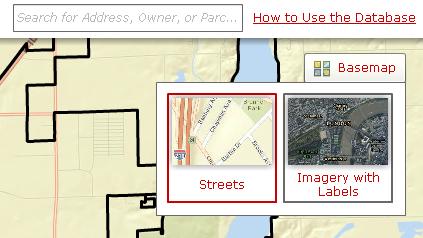
In addition to information regarding code violations, users can also toggle between a street map background and an aerial photo background. To turn on aerial photos, click on the "Basemap" icon, then select "Imagery with Labels." To return to the street map background, click on the "Basemap" icon, then select "Streets."
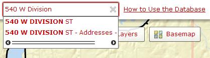
Enter an address, owner's name (Last name first. For example: SMITH JOHN), or parcel number (in the format 12-14-107-001) in the search box found in the upper right-hand corner of the screen:
A list of search results will display below the search box. Click on a result to zoom the map to it.
If the property has an active case on it, it will be highlighted in red. Click on the property to see information about the case(s).
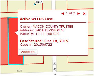
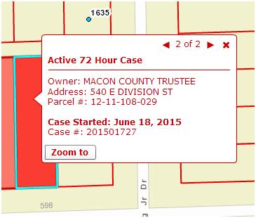
The pop-up will display the type of case, the owner's name, address, parcel number, the date the case was started, and the case number.
If a property has more than one active case, navigational arrows will display at the top of the pop-up:
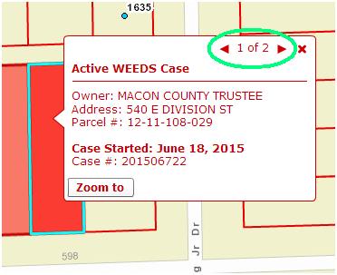
Click on the arrows to see information about all cases on that property.
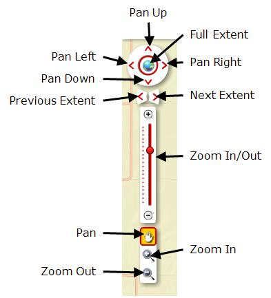
There are several ways to navigate the map.
First, you can search for a specific property (as described above) and the map will zoom to it.
Second, you can use the navigation tools on the left-hand side of the map to zoom in and out, pan left, right, up, or down or to zoom to a specific area on the map. The "Previous Extent" and "Next Extent" buttons allow you to return to a previous map extent or to the next map extent you have viewed (for example, if a user searches for "1 Gary K Anderson Plaza" and the map zooms to that property, clicking the "Previous Extent" button will return the user to the area of the map they were previously viewing). The "Full Extent" button zooms the map out to view the entire city.